
The Legible Land: A Comparative History of the Cadastre, from Rome to Adelaide
For most international buyers, the cadastre enters the story late and looks harmless: a visura catastale printed at the notary's office, a floor plan drawn in thin grey lines, a figure called rendita catastale that nobody seems to take very seriously. It is filed under formalities. It should not be.
The cadastre is one of the oldest technologies of power in Western history. Long before it became a database, it was a political decision: the decision of a ruler to know, parcel by parcel, what the land under his authority contained and whom it belonged to. Strictly speaking, not every system discussed here is a cadastre. Some map parcels for taxation, others record rights and guarantee title. But they grew from the same root, and they answer the same question in different ways.
This field note traces that lineage: where the cadastre came from, how it travelled, and why systems as different as the Italian catasto, the German Grundbuch, the English Land Register, the American county recorder and the Australian Torrens title turn out to share the same institutional DNA. It closes with what that history means, in practical terms, for anyone buying property in Italy today.
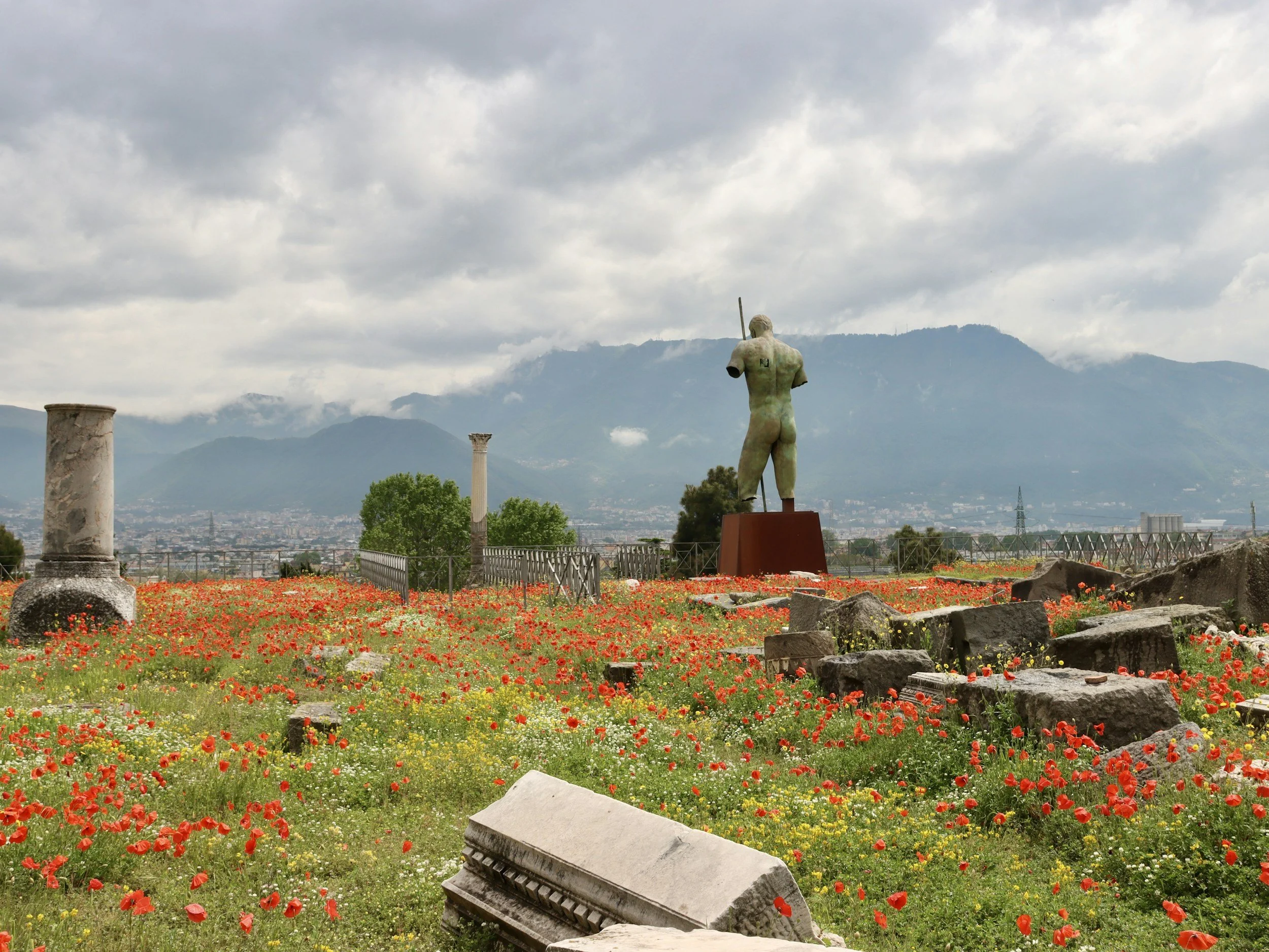
Pompeii
Before the Map: Measuring Land in Order to Tax It
The oldest account of land surveying in the Western tradition is already a story about taxation. Herodotus, writing in the fifth century BC, reports that the Egyptian king Sesostris divided the land into equal parcels and drew his revenue from an annual tax on each. When the Nile carried part of a plot away, the owner could petition the king, who sent men to measure the loss so that the tax could be reduced in proportion. Herodotus believed this was how the Greeks learned the art of measuring land. Geometry, in this telling, was born as a fiscal instrument.
Rome turned the principle into an imperial method. When a colony was founded, surveyors divided its territory into a regular grid, a practice known as centuriation, and allotted the squares to settlers, usually army veterans. The most striking survival is at Orange, in Provence: the colony of Arausio, founded after 36 BC for veterans of the Second Legion. Between 1949 and 1955, fragments of three marble plans were recovered in the town, once displayed inside a building on the forum. Engraved under Vespasian in AD 77, they recorded who occupied the land on the left bank of the Rhône, divided into squares of roughly 50 hectares, and the tax rate applied to each cultivated plot. It is, in effect, a cadastre carved in stone and posted in public.
The word itself carries the same memory. Dictionaries trace cadastre through French and Italian to the Old Italian, and specifically Venetian, catastico, and from there to the Late Greek katastichon, a register kept line by line. The word reached the West through Venice, the Italian state most closely bound to Byzantium. An alternative etymology, still repeated in Italian surveying manuals, links it instead to the Late Latin capitastrum, the register of the Roman head tax. Either way, the word points to the same object: a list drawn up by authority, so that authority could collect.
The Conqueror's Inventory: Domesday and the Florentine Catasto
The medieval cadastre was born of a specific kind of anxiety: that of a power which holds a territory without yet knowing it. At Christmas 1085, in Gloucester, William the Conqueror ordered a general survey of the kingdom he had taken by conquest nineteen years earlier. Commissioners toured the shires and put the same questions to sworn juries in local courts: who held each manor under King Edward, who held it now, how many ploughs, mills, men and animals it contained, and what it was worth. Every answer was given for three dates: before the Conquest, when William granted the land, and in 1086.
The National Archives describes the result as three things at once: a fiscal inventory of taxable values, a feudal statement of how estates were structured, and a legal record of which tenant rightfully held what. By the twelfth century the English called it Domesday, after the Day of Judgment, because there was no appeal against its evidence. Domesday already contains the whole program of every later cadastre. It is fiscal, it is juridical, and it is political: a conquering elite legitimizes a redistribution of land by writing it down. What it lacks is the map. Domesday describes; it does not measure.
The Italian word became famous in a similar moment of pressure. On 24 May 1427, with the Florentine Republic in fiscal crisis after protracted wars with Milan, the Priors decreed an entirely new tax survey of the city and its territory: the Catasto. Households filed portate, sworn declarations of their real estate, business investments and holdings in the public debt, which officials condensed into registers called campioni. The survey was far more rigorous, and more equitable, than the older estimi, and it survives almost intact in the Archivio di Stato in Florence, where it has fed decades of scholarship on Renaissance society. But it still rested on declaration rather than measurement. The citizen told the state what he owned; the state had limited means to check.
From Declaration to Geometry: The Eighteenth-Century Turn
The decisive change came in the eighteenth century, and much of it happened on the Italian peninsula and in the western Alps. Sweden had begun mapping farmland on a national scale as early as 1628, but it was a handful of reforming monarchies, trying to tax land that privilege had long shielded, that turned the geometric cadastre into a model for Europe. Their innovation was simple to state and enormously costly to perform: stop asking owners what they hold, and measure it.
In the Duchy of Savoy, Victor Amadeus II launched a general survey in 1728. In ten years, teams of surveyors, assessors and clerks produced more than 1,350 plans at a uniform scale of roughly 1:2,400, covering some 640 communes and around four million parcels. The aim, as a recent study of the reform explains, was to tax the land rather than the person, and to bring part of the estates of the nobility and, more marginally, of the clergy into the tax base. Draft registers were posted in each parish for fifteen days so that owners could file objections before the figures became final. Among the clerks was a young Jean-Jacques Rousseau, who later recalled the work in his Confessions.
In Milan, which had passed from Spanish to Austrian rule during the War of the Spanish Succession, Emperor Charles VI created a Royal Census Board by a dispatch of 7 September 1718, with a mandate to rebuild the duchy's fiscal system on a new cadastre. Surveyors mapped the territory parcel by parcel with the plane table, the tavoletta pretoriana, whose use was made compulsory by imperial decree at the urging of the court geodesist Giovanni Giacomo Marinoni. The work stalled in 1733 and resumed in 1749 under Maria Theresa, whose new board had to settle the thorniest question of all: the tax exemptions enjoyed by laymen and clergy. The Catasto teresiano came into force in 1760. It is considered the first geometric parcel cadastre whose formation records have survived, and its core logic still underpins Italian practice: each parcel carries a number, the same number appears on the map and in the register, and the tax follows the parcel.
Not every reforming state got that far. In the Kingdom of Naples, Charles of Bourbon ordered a general cadastre in 1740–41, the catasto onciario, named after the oncia, the unit of account in which incomes were expressed. It was compiled from owners' declarations and local appraisals, and it was purely descriptive, with no maps. The effort to curb clerical and aristocratic privilege succeeded only in part. In one small community studied in detail, the local duke held nearly 40 percent of the land and paid two ducats, while resident families with less than 8 percent of the assessed income bore more than 80 percent of the local tax. A geometric cadastre is not merely a better technique. It is evidence of a state strong enough to measure what the powerful would rather keep unmeasured.
The Italian experiments were watched closely. In 1763–64 an official of the French royal finances toured the cadastres of the Milanese and the Savoyard states to assess whether they could be reproduced in France. He concluded that France lacked the local institutions to carry them out. It would take a revolution, and then an emperor, to change that.
Two European Families: Napoleon's Cadastre and the Austrian Land Book
The nineteenth century split continental Europe into two families of land administration, and Italy ended up with both.
The first was French. In 1790 the revolutionary assembly abolished the old taxes and replaced them with a single contribution on landed property, proportional to its net income. That required knowing every parcel, and on 15 September 1807 a finance law launched the cadastre parcellaire, a parcel-by-parcel survey of France largely completed in the metropolitan territory by around 1850. Napoleon understood what was at stake. In 1807 he wrote to his finance minister that a good cadastre would be the complement of his Civil Code in all that concerned the possession of land, with maps detailed enough to fix property boundaries and prevent lawsuits. That ambition was never fulfilled. The French cadastre remained a tax instrument, and to this day its plan is not a title of ownership and does not fix property boundaries. Title rested on notarial deeds, made public in the registers of the conservation des hypothèques and organized by the names of the parties rather than by parcel. Napoleonic administration carried this architecture across much of Europe, including the Italian states. It is the direct ancestor of Italy's split between the catasto and the Conservatoria dei Registri Immobiliari.
The second family was Austrian and German. By the Land Tax Patent of 23 December 1817, Emperor Francis I ordered a survey of the entire empire. Between 1817 and 1861, some 300,000 square kilometers and more than 50 million parcels were measured and mapped, including the empire's Italian-speaking provinces. On this cadastral base Austria built a land book, the Grundbuch, governed from 1871 by a general statute. Its logic is the opposite of the French one: the book is organized by parcel, not by person, and a right in land comes into existence only when it is inscribed. The German states followed a parallel path. Under the Civil Code that entered into force across the German Empire on 1 January 1900, a buyer who relies in good faith on the land register acquires as if its contents were correct, even when the registered owner was not the true one.
Borders moved; the registers stayed. When Trentino, South Tyrol, Trieste and Gorizia passed to Italy after the First World War, a royal decree of 28 March 1929 kept the Austrian land-book law of 1871 in force almost unaltered. Today the Libro fondiario still operates in the provinces of Trento, Bolzano, Trieste and Gorizia, and in some municipalities of the provinces of Udine, Brescia, Belluno and Vicenza, border communities that once belonged to Tyrol or other Habsburg lands. France has the mirror image. Alsace-Moselle, German from 1871 to 1918, kept the German land book after returning to France, under a law of 1 June 1924. In both countries, a map of land registration systems is still a map of nineteenth-century sovereignty.
Italy: Unifying a Nation by Measuring It
When Italy was unified in 1861, it inherited not one cadastre but a patchwork. In the mid-1880s the new kingdom still counted more than twenty official cadastres, grouped into nine compartments, built with different methods, units, scales and valuation rules. Some were geometric and mapped; others, typically where land was concentrated in great estates, were merely descriptive. Land of similar quality could be taxed at very different rates depending on which pre-unitary state had drawn up its register. For a young nation, this was more than a technical nuisance. It was a daily reminder that Italy was not yet one country.
The answer was the law of 1 March 1886, no. 3682, known after its rapporteur, the economist Angelo Messedaglia. Its first article ordered the State to form, across the whole Kingdom, a uniform geometric parcel cadastre based on measurement and valuation, with two stated purposes: to ascertain real property and record its changes, and to equalize the land tax. The law held out a further promise. In time, the new cadastre was to acquire legal force as proof of ownership, a result that, as Luigi Einaudi wrote in 1912, would come at long range and at great expense, but would come in the end.
It never came. The task proved immense, and it was political from the first day. The same 1912 pamphlet, co-signed by Einaudi, noted that after a quarter of a century fewer than twenty of Italy's sixty-nine provinces were on the new cadastre, which had grown old before it was finished. It documented how the Ligurian province of Porto Maurizio, today's Imperia, lobbied Rome until the technical board whose valuations would have raised its taxes was dissolved. Where the surveyors did finish, measurement exposed what declaration had hidden: in the province of Modena the new survey found some 49,000 hectares more than the old registers, in Reggio Emilia some 48,000. Interrupted by two world wars, the survey was completed only in 1956, about seventy years after the law. A separate cadastre for urban buildings, the Nuovo Catasto Edilizio Urbano, was created by a decree of 13 April 1939.
The result is the catasto every buyer meets today, administered by the Agenzia delle Entrate. Einaudi himself, in 1946, called it an Italian glory, and technically it is one. Yet by law and by practice it remained a fiscal instrument: it identifies and values property, but it does not prove who owns it. Its valuations have also aged exactly as Einaudi feared. The estimates still applied to urban buildings refer to the economic period 1988–1989, and attempts to revise them in 1998, 2005, 2011, 2013 and 2014 did not succeed.
England: A Register Without a Cadastre
England, which produced the most famous survey of the Middle Ages, never built a continental-style cadastre. For centuries, ownership was proved not by a public record but by a private bundle of title deeds, handed from seller to buyer and examined by lawyers. Repeated attempts to create a general register of conveyances failed; only a few areas, such as Middlesex, the Yorkshire ridings and the Bedford Level in the Fens, ever had local deeds registries.
The nearest thing to a national parcel survey came through the Church. Tithes, the tenth of farm produce owed to the clergy or to the lay owners who had inherited the right after the Reformation, had become so contested that the dispute erupted into rural riots in the early 1830s. The Tithe Commutation Act of 1836 converted them into money payments, and to calculate each landowner's share the land had to be surveyed, valued and mapped, plot by plot. The survey covered some 11,830 tithe districts. Only about 1,900 maps, roughly one in six, were sealed as first class, accurate enough to serve as legal evidence of boundaries; the rest ranged down to little more than topographical sketches.
Registration, when it finally came, answered a different need. The Royal Commissions of 1829–30, 1850 and 1857 were concerned with the difficulty and cost of proving title, and the Land Registry Act of 1862 was meant to make dealings in land simple and economical. It was voluntary, and it struggled from the start. Compulsory registration on sale began in parts of the country under the Land Transfer Act of 1897 and spread area by area; it was only in 1990 that every property purchase in England and Wales had to be registered. Today HM Land Registry provides a title guaranteed by the government, but a title plan that indicates only general boundaries. The State guarantees who owns; it does not guarantee exactly where the line runs.
Scotland had taken a different road much earlier. The Registration Act of 1617 created the General Register of Sasines, the oldest national public land register in the world: a chronological register of deeds, with properties described in words rather than drawn on maps. Only with the Land Registration (Scotland) Act 1979 did Scotland create a map-based register, which the Scottish Land Commission describes as a very limited form of cadastre. In Britain, in other words, the register grew out of the conveyancer's problem, not the treasury's.
America: The Grid Before the Settler
The United States inverted the European sequence. In Europe the cadastre measured a landscape that centuries of occupation had already shaped; in the American West, the survey came first and the landscape followed. Emerging from the Revolution with war debts, no power of direct taxation under the Articles of Confederation and a vast territory beyond the Appalachians, Congress adopted the Land Ordinance of 20 May 1785, reworking a proposal by Thomas Jefferson. Land had to be surveyed before it could be sold or settled: townships six miles square, each divided into 36 sections of 640 acres, with section 16 reserved for schools.
The survey began where the western boundary of Pennsylvania meets the Ohio River, and the first township was completed in 1786. Under the same principles, according to the Bureau of Land Management, some 1.5 billion acres were eventually surveyed into townships and sections. The Public Land Survey System covers all or part of thirty states, and its logic is visible from the window of any flight over the Midwest: roads, fields and county lines that follow the grid rather than the terrain.
The grid also presupposed an emptiness that did not exist. The ordinance itself speaks of territory purchased of the Indian inhabitants, and the Indiana Historical Bureau notes that removing the Native peoples was the first step of the survey process, pursued through treaties and military force. The American public-land survey is the purest case of measurement as an act of sovereignty: land became private property only after the new power had measured it.
Once land passed into private hands, the federal survey stepped back. Title was left to a decentralized system in which county offices record deeds but do not guarantee the rights those deeds describe; someone has to search the record and interpret it. The weakness of that arrangement produced America's most distinctive institution. In Watson v. Muirhead (1868), the Pennsylvania Supreme Court held that a conveyancer who had relied on a lawyer's mistaken opinion about a lien was not liable for the buyer's loss. Pennsylvania authorized title insurance companies in 1874, and on 28 March 1876 the Philadelphia conveyancer Joshua Morris and several colleagues incorporated the first one. Where Europe asked the State or the notary to guarantee title, America priced the risk and sold it.
Australia: Title by Registration
South Australia, founded as a planned colony in 1836, met the English problem in an acute form. Land was bought, sold and mortgaged at colonial speed, while the inherited English system of title deeds was slow, costly and, as its critics complained, open to abuse. The reform that bears the name of Robert Richard Torrens, colonial treasurer and later Registrar-General, cut the knot. The Real Property Act, assented to on 27 January 1858 despite very strong opposition, mainly from the legal profession, rested on three principles. Title passes by registration on a public register, not by the execution of deeds. Once registered, the purchaser's title is indefeasible except for fraud. And anyone who deals innocently with registered land is guaranteed either the land itself or monetary compensation.
The system has a revealing ancestry. Torrens borrowed from the way British law registered the ownership of ships, and from a German source. Ulrich Hübbe, a Hamburg-born jurist living in Adelaide, advocated the system of registration and indefeasibility of title used in Hamburg and the other Hanseatic towns, translated it into English and advised Torrens while the bill passed. How much the final law owes to Hamburg is still debated by Australian legal historians. The family resemblance, however, is plain: the Torrens register, the German Grundbuch and the Libro fondiario of Trento all make the public register, not the private deed, the source of the right.
Torrens title spread quickly. Queensland adopted it in 1861, and New South Wales, Tasmania and Victoria followed; it later reached New Zealand, parts of Canada and many other jurisdictions. Yet the register rested on a legal fiction. British sovereignty had been asserted over the continent on the doctrine of terra nullius, land belonging to no one, and the new titles were carved out of country held under Aboriginal and Torres Strait Islander law and custom. Only on 3 June 1992, in Mabo v Queensland (No 2), did the High Court of Australia overturn terra nullius and recognize native title, upending a principle that had stood for 204 years. The most perfect register in the world had been built on the assumption that, before it, there was nothing to register.
What They All Have in Common
Set side by side, the American grid, the English register, the Italian catasto, the German land book and the Australian Torrens title look like five different answers. Historically, they are five versions of the same operation, and they share at least five constants.
They are born of rupture. Every system in this story appears when a power has to govern a territory it did not make: a conquering king in 1085, a Habsburg emperor in newly acquired Milan, a revolutionary state sweeping away the old taxes, a newly unified Italy, a young republic on its western frontier, a colony on another continent. The cadastre is how a new sovereign learns to read an old land, or claims to read an "empty" one.
They turn territory into parcels. Before the cadastre, land was a web of overlapping claims: use rights, customary dues, feudal obligations, communal pastures. The map reduces that web to a single figure: one parcel, one number, one holder. Historians of the Savoyard reform have shown how its maps simplified the tangle of rights that burdened each plot and helped consolidate the modern idea of exclusive private property. The political scientist James C. Scott made the general point: a cadastral map drawn to identify taxpayers does not merely describe land tenure, it creates it, by giving its categories the force of law. That abstraction is what makes land both taxable and tradable.
Tax comes before title. Almost everywhere, the State measured land to extract revenue long before it measured land to guarantee rights. The plans of Orange recorded tax rates; Domesday assessed the king's dues; the cadastres of Savoy, Milan, Naples and unified Italy were built to distribute the land tax; the American survey was designed to raise money by selling the public domain. The promise that the cadastre would one day prove ownership, made explicitly in Italy in 1886, was kept only where a separate institution, the land book, took on that role. England and Australia are the telling exceptions: their registers were built for the market, to make conveyancing cheaper and safer, not for the treasury.
The real difference is who carries the risk of error. Every system must answer one question: when the record is wrong, who pays? In the Torrens and German traditions, and in Italy's Libro fondiario, the State stands behind the register. In England the State guarantees the title but not the exact line on the ground. In the United States, private insurers price the risk and carry it. In most of Italy, the risk is managed by the notary, who is personally liable for the checks he performs, and by the buyer's own due diligence, because the catasto guarantees nothing about ownership.
Borders move; registers stay. Once built, cadastral systems outlive the powers that created them. The Austrian land book survives in Trento and Trieste a century after the Habsburgs, the German one in Strasbourg, the Jeffersonian grid across the Midwest. In Savoy, farmers were still consulting the eighteenth-century maps to settle boundary disputes in the 1950s. The historical geographer Roger Kain has described how Napoleon's maps became "an instrument for erasing the past"; in the long run, they also became the past's most durable deposit.
The cadastre, in short, is never a neutral inventory. It is a political settlement about land, frozen into a register, and every buyer who signs a deed inherits the terms of that settlement.
What This History Means for a Buyer in Italy Today
For an international buyer, this long history compresses into five practical facts.
The visura catastale identifies the property; it does not prove who owns it. That is the direct inheritance of a fiscal cadastre. In most of Italy, ownership rests on the chain of notarial deeds recorded in the property registers, the old Conservatoria, now the property publicity service of the Agenzia delle Entrate. Before the deed is signed, the notary examines that chain, typically over the previous twenty years.
Since 2010, the fiscal and the legal records have been forced into dialogue. A deed transferring a building must contain, under penalty of nullity, the cadastral identification, a reference to the floor plans on file and the owners' declaration that cadastral data and plans match the actual state of the property. The notary must also check that the owners listed in the cadastre match those in the property registers. The cadastre remains a tax instrument, but a mismatch can now stop a sale.
Cadastral conformity is not legality. A floor plan can match a building perfectly while the building itself lacks the municipal permits that make it lawful. That gap, between the fiscal record and the stato legittimo documented in municipal archives, is the core of pre-purchase due diligence; we examined it in detail in Beyond the Cadastral Facade.
The cadastre's age can work in the buyer's favor. When a private individual buys a home in a sale subject to registration tax, typically from another private owner, the tax can be calculated on the cadastral value rather than on the price, provided the buyer asks the notary to apply this prezzo-valore rule in the deed itself. Because cadastral values still reflect the economic conditions of 1988–89, the difference can be substantial.
Geography still matters. In Trentino, South Tyrol, Trieste, Gorizia and the other tavolare areas, the Habsburg land book governs. The transfer is perfected only when a judge authorizes its entry in the Libro fondiario, and the register then enjoys public faith. The timeline is different, and so is the degree of certainty the buyer obtains.
None of this is a reason for alarm; it is a reason for method. The Italian system is not deficient, it is layered, and each layer answers to a different chapter of history. The catasto was built to tax, not to reassure. Read for what it is, a fiscal map of a legal reality kept elsewhere, it becomes one of the most detailed land records in the world.
Sources:
Herodotus, Histories 2.109, trans. A. D. Godley — Perseus / Perseids
Encyclopædia Universalis — Orange, France
Merriam-Webster — Cadastre
Online Etymology Dictionary — Cadastral
Middle Ages and eighteenth century
The National Archives (UK) — Domesday Book, series E 31
Brown University — About the Online Catasto of 1427
Savoirs (Huma-Num) — Le cadastre sarde (XVIIIe siècle)
Agenzia delle Entrate — Il patrimonio topografico e cartografico del Catasto (Museo del Catasto)
Archivio di Stato di Pavia — Catasto «Teresiano», inventory
Politecnico di Milano — Cartografia storica: il Catasto Teresiano
R. De Iulio, P. Cofrancesco, Semestrale di Studi e Ricerche di Geografia (2023) — Il catasto onciario di Massa Inferiore
Nineteenth-century Europe
Archives départementales d'Indre-et-Loire — L'établissement du cadastre napoléonien
Archives d'Orléans Métropole — Le cadastre napoléonien
Ministère de l'Économie (France) — Tout savoir sur le cadastre
Niederösterreichisches Landesarchiv — 200 Jahre Franziszeischer Kataster
Justiz NRW — Öffentlicher Glaube des Grundbuches
Senato della Repubblica — Disegno di legge n. 1295 (1955) sui Libri fondiari
Provincia autonoma di Trento — Libro fondiario – tavolare
Assemblée nationale — Réponse ministérielle sur le Livre foncier d'Alsace-Moselle
Unified Italy
Ordine degli Ingegneri — Seminario: le origini del Catasto Terreni (2017)
L. Einaudi and "Spectator", La Riforma Sociale (1912) — Per la perequazione catastale
Diritto.it — L'attuale sistema di classamento
Osservatorio sui Conti Pubblici Italiani, Università Cattolica (2022) — I passati tentativi di riforma del catasto
England and Scotland
The National Archives (UK) — Records of the Land Registry
The National Archives (UK) — Research guide: Tithes
British Academy Review (2019) — Interview with Roger Kain
Estates Gazette — Land Registry attempts a comprehensive exercise
HM Land Registry — About us
Registers of Scotland — Our registers
Scottish Land Commission (2026) — Learning from international cadastral systems: the Scottish context
United States
Bureau of Indian Affairs — General Land Office records history
Bureau of Land Management — Surveying Our Public Lands (2002)
Oregon-California Trails Association — The Public Land Survey System
State Historical Society of Iowa — Land Ordinance of 1785, transcribed excerpts
Indiana Historical Bureau — Buckingham's Base Line
American Land Title Association — Philadelphia: the birthplace of title insurance
Australia
Australian Dictionary of Biography — Torrens, Sir Robert Richard
Australian Dictionary of Biography — Hübbe, Ulrich
University of Adelaide — The Torrens system and the Hamburg debate
History Trust of South Australia, SA History Hub — Robert Torrens
Australian National University, H. Reynolds — 1992: Mabo v. Queensland
Synthesis and buyer notes
Refubium, Freie Universität Berlin — S. Richardson on James C. Scott and the cadastre
Agenzia del Territorio — Circolare n. 2 del 9 luglio 2010 (via ANCE)
Italy Buying Agent — Beyond the Cadastral Facade
Further reading
Roger J. P. Kain and Elizabeth Baigent, The Cadastral Map in the Service of the State: A History of Property Mapping (University of Chicago Press, 1992)
James C. Scott, Seeing Like a State (Yale University Press, 1998)
